About Me

My photo
NASHIK, Maharashtra, India

29 September, 2020

सातमाळा पर्वत रांगेतील सर्वात उंच किल्ला : धोडप


धोडप किल्ला

नाशिक जिल्हयातील कळवण तालुक्यात हा किल्ला आहे. नाशिक जिल्ह्याच्या मध्यभागातून जाणारी सह्याद्रीची पूर्व-पश्चिम डोंगररांग म्हणजे अजंठा-सातमाळा ही होय. अजंठा-सातमाळा रांग म्हणजे गिरीदुर्गाची साखळी आहे.

या साखळीमधील सर्वात उंच आणि बलदंड किल्ला म्हणजे धोडप हा होय. साल्हेरनंतर हा सह्याद्रीच्या पर्वतातील सर्वात उंच किल्ला आहेहा किल्ला समुद्रसपाटीपासून ४८२९ फूट (१४७२ मीटर) उंच आहे. 

सर्वात उंच किल्ला असल्याने आपणास संपूर्ण प्रदेशावर दृष्टीक्षेप टाकता येतो. शिवलिंगासारख्या आकाराचा माथा असलेला धोडप या आकारामुळे दूरवरुन स्पष्टपणे ओळखू येतो. माचीसारखा भाग मोकळा उंचावर असल्यामुळे येथून गडाचा परिसर तसेच धोडपचा वरचा सुळका उत्तम प्रकारे दिसतो. 

येथून चांदवड, इंद्राई, कांचन-मंचन, इखारा, कन्हेरा, रावळ्या-जावळ्या, सप्तश्रृंगी, अहिवंतवाडी, अचला अशी सातमाळा रांग पहायला मिळते. दक्षिणेकडील विस्तृत प्रदेश न्याहाळता येतो. तसेच उत्तरेकडील साल्हेर-सालोटा चे दर्शन होते.

किल्ल्याचा वरचा भाग दगड आणि वीटा या दोहोंचा वापर करून बांधला आहे. येथे भगवान हनुमानाची मूर्ती असलेली एक टाकी आहे. तसेच येथे एक २९ मीटर रुंद बोगदा आहे. 

वरील सुळक्याच्या मागील बाजूस एक मोठी मानवनिर्मित गुहा व काही पाण्याची टाकी आहेत. पायथ्याशी एक गुहा आहे. एका गुहेत वसलेले एक मंदिर सुस्थितीत आहे. काही इतर गुहाही सभोवताली दिसतात आणि आकाराने मोठ्या आहेत.

-----------------------------------------------------------------

The highest fort in the Satmala mountain range: Dhodap

This fort is located in Kalwan Taluka of Nashik district. Ajanta-Satmala is the east-west mountain range of Sahyadri which passes through the center of Nashik District. The Ajanta-Satmala Range is a chain of hills.

The tallest and strongest fort in this chain is Dhodap. It is the tallest fort in the Sahyadri mountains after Salher. The fort is 4829 feet (1472 meters) above sea level.

Being the tallest fort, you can see the whole region. Dhodap, which has a Shivling-like head, is clearly recognizable from a distance. Since the Machi-like part is at a clear height, the fort area as well as the upper cone of Dhodap can be seen from here.

From here one can see Satmala Range like Chandwad, Indrai, Kanchan-Manchan, Ikhara, Kanhera, Rawalya-Jawalya, Saptshrungi, Ahivantwadi, Achala. A wide area to the south can be seen. There was also a view of Salher-Salota to the north.

The upper part of the fort is built using both stone and brick. Here is a tank with an idol of Lord Hanuman. There is also a 29 meter wide tunnel.

At the back of the upper cone is a large man-made cave and some water tanks. There is a cave at the base. A temple situated in a cave is in good condition. Some other caves also look around and are larger in size.

26 September, 2020

ब्रिटीशांच्या काळातील धरण: चणकापुर

चणकापुर धरण

चणकापूर धरण हे  भारतातील   महाराष्ट्र    राज्यातील नाशिक जिल्ह्यातील कळवण तालुक्यात अभोणाजवळ गिरणा नदीवर बांधलेले आहे. हे धरण १९ व्या शतकात ब्रिटीशांनी बांधले होते. चणकापूर हे महाराष्ट्रातील सर्वात मोठे धरण आहे.

सर्वात कमी पाया असलेल्या धरणाची उंची ४१ मीटर (१३५ फूट) आहे तर लांबी ३,७०५ मीटर (१२,१५६ फूट) आहे. व्हॉल्यूम सामग्री २,१२३ किमी3 (५०९ क्यू मैल) आहे आणि एकूण संचयन क्षमता ७९,६९०.०० किमी3 (१९,११८.६५ क्यु मैल) आहे.

कळवण तालुका हा पावसाचा व धरणांचा तालुका म्हणून ओळखला जातो. कळवण तालुक्यात खुप लहानमोठी धरणे आहेत. 

ब्रिटीशांच्या काळात ह्या चणकापुर धरणाजवळ आदिवासी आणि इंग्रजांमध्ये खुप मोठी लढाई झाली होती. ह्या लढाईत खुप आदिवासी बांधव शहीद झाले होते. त्यांच्या स्मृति जपून ठेवण्यासाठी चणकापुर गावात शहीद स्तंभ आणि स्मृतिस्मारक बांधन्यात आले आहे.

----------------------------------------------------

British-era dam: Chanakapur

The Chanakapur Dam is built on the river Girna near Abhona in Kalwan Taluka of Nashik District in the Indian state of Maharashtra. The dam was built by the British in the 19th century.

The lowest dam has a height of 41 meters (135 feet) and a length of 3,705 meters (12,156 feet). The volume content is 2,123 km3 (509 cu mi) and the total storage capacity is 79,690.00 km3 (19,118.65 cu mi).

Kalwan Taluka is known as rain and dam Taluka. There are many small and big dams in Kalwan Taluka.

During the British rule, there was a big battle between the tribals and the British near the Chanakapur dam. Many tribal brothers were killed in this battle. A martyr's pillar and a memorial have been erected in Chanakapur Village to preserve his memory.

22 September, 2020

समेधशिखर: मांगी-तुंगी

मांगी -तुंगी

नाशिक जिल्हा अनेक आश्चर्यांनी नटलेला आहे. यात समेधशिखर म्हणून प्रसिद्ध असलेले मांगी-तुंगी हे क्षेत्र.

मांगी - तुंगी हा महाराष्ट्रातील एक किल्ला आहे. नाशिक जिल्ह्यातील सटाणा तालुक्यातील भिलवाड गावानजीक हा किल्ला उभा आहे. 

मांगी-तुंगी हे नाशिकपासून १२५ कि.मी. अंतरावर ताराबाद जवळील मध्यभागी पठारासह एक प्रमुख दुहेरी-उंच शिखर आहे. पश्चिमेकडील मांगी हे शिखर समुद्रसपाटीपासून ४,३४३ फूट (१,३२४ मीटर) उंच आहे, आणि पूर्वेकडील तुंगी हे शिखर ४,३६६ फूट (१,३३१ मीटर) उंच आहे. 

मांगी-तुंगी हे धुळे जिल्ह्यापासुन फक्त १०० किमी दूर आहे, धुळे हे उत्तर महाराष्ट्रातील एक सुप्रसिद्ध शहर आणि ह्या जिल्ह्याला खानदेश चा भाग म्हणून ओळखला जातो.

मांगी-तुंगी येथे नुकतीच जैन धर्मीयांचे पहिले तीर्थंकर भगवान ऋषभदेव यांची १०८ फूट उंच मूर्ती साकारण्यात आली आहे. तेथे चढून जाण्यासाठी सुमारे दोन हजारांहून अधिक पायऱ्या आहेत.

मांगी व तुंगी हे पर्वताचे दोन टोके आहेत. येथे जाण्यासाठी साडेचार हजार पायऱ्या चढाव्या लागतात. तुंगी पर्वतावर प्राचीन लेणी आहेत. गिरीराज नावाचे जलकुंड, अंतरिक्ष चैत्यालय, चंद्रप्रभू भगवंतांची मूर्ती पहाता येते. 

मांगी-तुंगीच्या मांगी या शिखराच्या खालच्या टप्प्यावर जगातील अखंड दगडातील सर्वात उंच १०८ फूटी श्री ऋषभदेवाची मूर्ती सध्या आकर्षणाचे मुख्य केंद्र आहे. त्यात १३ फुटाचे कमळ व १०८ फूट उंचीची मूर्ती पाहताना नवल वाटते. हा सोहळा अनुभवताना आपण नक्कीच खूश व्हाल.

डोंगरावर ऐतिहासिक आणि धार्मिक संदर्भ असलेल्या अनेक गुहा असून त्या महावीर गुहा, शांतीनाथ, आदिनाथ, पार्श्व म्हणून ओळखल्या जातात. 

मांगी डोंगरावर कृष्णकुंड असून, ते कृष्णाच्या शेवटच्या दिवसाचे प्रतीक समजतात. येथे सात मंदिरे असून, वरती जातानाच्या मार्गात अनेक पादुका कोरलेल्या दिसतात. तुंगी डोंगरावर पाच मंदिरे आणि दोन गुहा आहेत. 

मांगी आणि तुंगी यांना जोडणाऱ्या खिंडी सदृश मार्गातही २ गुहा आणि एक मंदिर आहे.

-----------------------------------------------------------------

Samedhshikhar: Mangi-Tungi

Nashik district is full of many surprises. The area known as Samedhshikhar is Mangi-Tungi.

Mangi - Tungi is a fort in Maharashtra. This fort stands near Bhilwad Village in Satana Taluka of Nashik District.

Mangi-Tungi is 125 km from Nashik. In the distance is a major double-elevated peak with a plateau in the middle near Tarabad. Mangi on the west is 4,343 feet (1,324 m) above sea level, and Tungi on the east is 4,366 feet (1,331 m) high.

Mangi-Tungi is just 100 km away from Dhule District, Dhule is a well known city in North Maharashtra and this district is known as part of Khandesh.

A 108 feet high idol of Lord Rishabhdev, the first Tirthankar of Jains, has recently been erected at Mangi-Tungi. There are over two thousand steps to climb there.

Mangi and Tungi are the two extremes of the mountain. It takes four and a half thousand steps to get here. There are ancient caves on Mount Tungi. A water tank called Giriraj, a space chaityalaya, an idol of Lord Chandraprabhu can be seen.

At the bottom of the Mangi-Tungi's Mangi peak, the world's tallest 108 feet idol of Lord Rishabh is currently the main attraction. It is amazing to see a 13 feet tall lotus and a 108 feet high idol. You will definitely be happy to experience this ceremony.

There are many caves on the hill with historical and religious references and they are known as Mahavir Cave, Shantinath, Adinath, Parshva.

There is a Krishnakunda on the Mangi hill, which symbolizes the last days of Krishna. There are seven temples here, and on the way up, you can see many padukas carved. There are five temples and two caves on Mount Tungi.

There are two caves and a temple in the gorge connecting Mangi and Tungi.

19 September, 2020

गुजरातचं प्रसिद्ध हिल स्टेशन : सापुतारा

सापुतारा

सापुतारा हे स्थळ भारताच्या गुजरात राज्यातील डांग जिल्ह्यातील एक थंड हवेचे ठिकाण आहे. हे महाराष्ट्र राज्याच्या नाशिक या शहरापासून सुमारे ८० कि.मी. अंतरावर नाशिक-डांग-सुरत रस्त्यावर आहे. हे ठिकाण गुजरात राज्याच्या वाझदा राष्ट्रीय उद्यानाजवळ आहे. मुंबई अथवा अहमदाबाद येथून रेल्वेने बिलीमोरा या स्थानकापर्यंत जाऊन तेथून बसने अथवा टॅक्सीने येथे येता येते. 

गुजरात-महाराष्ट्र राज्यसीमा येथून सुमारे ५ कि.मी. अंतरावर आहे. समुद्रसपाटीपासून सुमारे १००० मीटर उंचीवर असलेले सापुतारा हे स्थान सातपुडा पर्वतरांगेत एका पठारासारख्या ठिकाणी वसलेले आहे.

नैसर्गिक सौंदर्य आणि जैव-विविधतेने नटलेलं, सापुताऱ्यात वर्षभर थंड हवामान असतो आणि बरीच बाग, उद्याने आणि अभयारण्ये आहेत. आपल्या कुटुंबियांसह आनंद घेण्यासाठी सापुतारा एक आदर्श पर्यटन स्थळ आहे. 

हिल स्टेशनच्या सभोवतालची डोंगर आणि जंगले ट्रेकिंगच्या उत्साही लोकांसाठी एक आदर्श ठिकाण आहेत.  या शहराला 'सर्पांचा वास' म्हणून देखील ओळखले जाते आणि येथे सर्पगंगा नदीच्या काठावर नाग देवताचे मंदिर आहे.

नागेश्वर महादेव मंदिर, जैन मंदिर आणि स्वामीनारायण मंदिर यासह अन्य धार्मिक स्थानेही सापुताऱ्यात आहेत.  हिरव्यागार दरीच्या मधोमध खोल वसलेले सापुतारा तलाव हे मुख्य आकर्षण आहे आणि त्या तलावात नौकाविहाराची सुविधा उपलब्ध आहे. 

येथे स्टेप गार्डन, रोझ गार्डन आणि लेक गार्डन सारख्या काही सुंदर बगीचा आहेत. पुष्पक रोप-वे म्हणून ओळखला जाणारा रोप-वे पर्यटनासाठी आणखी एक आकर्षण आहे कारण आजूबाजूच्या परिसरातील पक्ष्याचे दर्शन घडवते. 

सापुताऱ्यात पाहण्यासारखी खुप ठिकाणे आहेत त्यामधे अ‍ॅक्वेरियम, इको पॉईंट, कलाकारांचे खेडे (आर्टिस्ट्‌स व्हिलेज), मध संकलन केंद्र, गीरा धबधबा, बोट क्लब, म्युझियम (संग्रहालय), रोप-वे, सनराइज पॉईंट, सनसेट पॉईंट, हतगड किल्ला, इत्यादी.

कोकणा, भिल्ल, महादेव कोळी आणि वारली हे येथील आदिवासी जमातीचे मुख्य समुदाय आहेत आणि त्यांचा मुख्य व्यवसाय शेती आहे. त्यांच्या गावाला भेट द्या जिथे आपणास त्यांचे जीवन आणि संस्कृती जवळच्या ठिकाणाहून अनुभवता येईल. गावकरी खूप आदरातिथ्य करणारे आहेत. 

वारली चित्रकला किंवा इतर आदिवासी हस्तकला येथे आपणास पहावयास मिळतील. सापुतारा संग्रहालयात विविध प्रकारचे कपडे, भांडी, पारंपारिक कलाकृती, जीवनशैली, डांग आदिवासींची घरे दर्शविली आहेत. संग्रहालयात विविध कार्यशाळा देखील आयोजित केल्या जातात.

-------------------------------------------------------------------

Gujarat's famous Hill Station: Saputara

Saputara is a cool place in Dang district in the Indian state of Gujarat. It is about 80 km from Nashik city of Maharashtra state. In the distance is Nashik-Dang-Surat road. This place is near Wazda National Park in Gujarat State. You can reach Bilimora by train from Mumbai or Ahmedabad and from there by bus or taxi.

About 5 km from Gujarat-Maharashtra state border is at a distance. Saputara, situated at an altitude of about 1000 m above sea level, is situated on a plateau in the Satpuda range.

Surrounded by natural beauty and biodiversity, Saputara enjoys cool weather all year round and has many gardens, parks and sanctuaries. Saputara is an ideal tourist destination to enjoy with your family.

The hills and forests surrounding the hill station are an ideal place for trekking enthusiasts. The city is also known as the 'Snake Scent' and has a temple of the snake deity on the banks of the river Sarpganga.

Other religious places including Nageshwar Mahadev Temple, Jain Temple and Swaminarayan Temple are also in Saputara. Deep in the middle of the green valley, Saputara Lake is the main attraction and boating facilities are available in that lake.

There are some beautiful gardens like Step Garden, Rose Garden and Lake Garden. The ropeway, also known as the Pushpak Ropeway, is another attraction for tourism as it offers birds watching in the surrounding area.

There are many places to see in Saputara including Aquarium, Eco Point, Artist's Village, Honey Collection Center, Gira Waterfalls, Boat Club, Museum, Ropeway, Sunrise Point, Sunset Point, Hatgad Fort, etc.

Kokana, Bhill, Mahadev Koli and Warli are the main tribal communities here and their main occupation is agriculture. Visit their village where you can experience their life and culture from a nearby place. The villagers are very hospitable.

You will find Warli paintings or other tribal handicrafts here. The Saputara Museum displays a variety of clothing, utensils, traditional artefacts, lifestyles, and Dang tribal homes. Various workshops are also conducted in the museum.


18 September, 2020

नेकलेस पॉइंट: अर्जुन सागर (पुनद धरण)


अर्जुनसागर
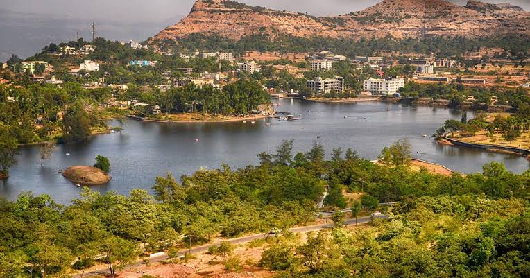
नाशिकच्या कळवण तालुक्यातील पुनद नदीवर एक नयनरम्य जलाशय आहे अर्जुन सागर. कळवण तालुक्याचे दिवंगत आमदार श्री. ए. टी. पवार साहेब यांच्या नावावरून ह्या धरणाला अर्जुन सागर हे नाव देण्यात आले आहे. तब्बल ६१० दशलक्ष घनमीटर  पाण्याची साठवण क्षमता असलेल्या या धरण परिसराचा परीघ दाट जंगलाने वेढलेला आहे.

या पुनद अर्जुनसागर निसर्ग पर्यटन क्षेत्रात प्रतापनगर, उंबरदे, काठरे दिगर ही वनक्षेत्रे येतात. धरणालगतचे हे वनक्षेत्र एकूण १३०० हेक्टर क्षेत्रफळाचे आहे. 

या आदिवासीबहुल क्षेत्रात कोकणा, महादेव कोळी, भिल्ल आणि इतर समाजाचे लोक त्यांच्या स्थानिक संस्कृतीसह सण-उत्सव साजरे करताना आणि लोककला आणि लोकसंस्कृतीचे जतन करताना दिसतात. धरणाच्या पाण्यामुळे इथला शेतकरीही सुखावलेला आहे. येणाऱ्या पर्यटकांना इथल्या ग्रामीण जीवनाबरोबर आदिवासी पदार्थाची चवदेखील चाखता येते. पर्यटकांसाठी अर्जुनसागर निसर्ग पर्यटन केंद्र म्हणजे पर्यटनाचा मनमुराद आनंद देणारं  केंद्र असंच त्याचं वर्णन करावं लागेल.

पावसाळ्यात भोवतालच्या डोंगररांगांतून वाहणारे छोटे-मोठे धबधबे त्यातून वाहणारे असंख्य ओहोळ, झरे आपल्या मनाला प्रसन्न करून जातात. गंगा-जमुना हे भूगर्भातील पाण्याचा स्रोत असलेले दोन मोठे तलाव हे या वनातील नैसर्गिक खजिनाच आहेत. 

डोंगररांगांमधून धावणारी चढ-उताराची वाट आपल्याला अनेक दुर्मीळ वनस्पतींबरोबर डेरेदार वृक्षांचे दर्शन घडवते. त्याच्या सावलीखालून फिरण्याची संधी देते. खैर, आवळा, साग, जांभूळ, आंबा, रानभेंडी, पिंपळ, वड अशा अनेक वृक्षांची दाटी आपण इथे पाहू शकतो. राष्ट्रीय पक्षी मोर, राज्य पक्षी हरियाल, यासारख्या पक्ष्यांबरोबर असंख्य पक्षी अर्जुन सागराभोवती मस्त विहरताना आणि दिसतात. अनेक स्थालांतरित पक्षी आणि पाणपक्षी आपलं अस्तित्व या जलाशयात दाखवत असतात. 

निसर्गप्रेमी, गिर्यारोहक, साहसवीर, पक्षीप्रेमी यांच्यासह वन्यजीवतज्ज्ञांची येथे नेहमीच गर्दी असते. सह्याद्री पर्वतरांगेच्या कुशीत वसलेल्या या अर्जुन सागर जलाशयाच्या परिसरात साल्हेर किल्ल्याचे विहंगम दृष्य दिसते.

---------------------------------------------------------------------------------------------------------------------

Necklace Point: Arjun Sagar (Punad Dam)

Arjun Sagar is a beautiful reservoir on the river Punad in Kalwan Taluka of Nashik. The name of Arjun Sagar on late MLA of Kalwan Taluka Shri. A. T. Pawar.  With a storage capacity of 610 million cubic meters of water, the dam area is surrounded by dense forest.

Pratapnagar, Umbarde, Kathare Digar are some of the forest areas in the Arjun Sagar nature tourism area. The forest area near the dam is 1300 hectares in total.

In this tribal-dominated area, people from Kokana, Mahadev Koli, Bhill and other communities are seen celebrating festivals with their local culture and preserving folk art and folk culture. Due to the water of the dam, the farmers here are also happy. Visitors can enjoy the taste of tribal food along with the rural life here. For tourists, Arjun Sagar Nature Tourism Center has to be described as a center of tourism.

In the rainy season, small and big waterfalls flow through the surrounding hills and innumerable streams and springs flowing through it make our mind happy. The Ganga-Jamuna, two large lakes with a source of groundwater, are the natural treasures of this forest.

The ups and downs of the mountains give you a glimpse of deciduous trees with many rare plants. Gives a chance to walk under his shadow. We can see many trees like Khair, Awla, Sag, Jambhul, Mango, Ranbhendi, Pimpal, Wad. Along with birds like national bird peacock, state bird Hariyal, innumerable birds are seen roaming around Arjun Sagar. Many migratory birds and waterfowl show their existence in this reservoir.

There is always a crowd of wildlife experts including nature lovers, mountaineers, adventurers, bird lovers. Situated in the foothills of the Sahyadri range, the Arjun Sagar Reservoir offers a panoramic view of Salher Fort.


17 September, 2020

खोल दरी: भेगू

भेगू दरी


नाशिक जिल्ह्यातील गुजरात सीमेवर असणारे हे रमणीय एकदम खोल दरी असणारे प्रसिद्ध असे स्थळ ते म्हणजे भेगू.

ही दरी कळवण मधील मांगलीदर या गावी आहे. हे गाव एकदम गुजरात सीमेवर आहे. ह्या दरी नजदीक खूप जंगल आहे. गुजरात आणि महाराष्ट्र राज्याच्या सीमेवर असल्या कारणाने इथे पावसाळ्यात पर्यटकांची खूप गर्दी जमते.

मांगलीदर धरणातील पाणी ह्या दरीतून खोलवर कोसळते. मोठा धबधबा आहे. हे पाणी गुजरात मध्ये जाते. पर्यटक या दरीत मनसोक्त आनंद लुटतात. दरीच्या काठावरून दरीत बघितलं तर नजर पोहचत नाही इतकी खोल दरी आहे.

असे म्हणतात की पूर्वी इथे खूप मोठा डोंगर होता, पण तो कालांतराने नाहीसा झाला आणि एक दरी तयार झाली.


------------------------------------------------------------------

Deep Valley: Bhegu

Bhegu is a famous place with a very deep valley located on the Gujarat border in Kalwan Taluka of Nashik District.

This valley is in the Village of Manglidar in Kalwan. This village is near the Gujarat border. There is a lot of forest near this valley. Being on the border of Gujarat and Maharashtra, it attracts a lot of tourists during the monsoons.

The water from Manglidar dam falls deep through this valley. There is a big waterfall. This water goes to Gujarat. Tourists enjoy this valley to their heart's content. If you look at the valley from the edge of the valley, the valley is so deep that it cannot be seen.

It is said that there used to be a very big mountain here, but over time it disappeared and a valley formed.


दरी

दरीतील धबधबा


खळखळ वाहणारं पाणी


06 September, 2020

सातमाळेतला रक्षणकर्ता: मोहंदरी गड


मोहंदरी उर्फ शिडका किल्ला नाशिक जिल्ह्यातील कळवण तालुक्यात आहे. हा किल्ला नाशिक जिल्ह्यातील एक महत्त्वाचा किल्ला आहे. अचला, अहिवंत आणि मोहंदरी हे तीन किल्ले जवळच आहेत. हा किल्ला अहिवंत किल्ल्याच्या रक्षणासाठी बांधण्यात आला होता. या किल्ल्याच्या खाली असलेल्या डोंगराला छिद्र असल्यामुळे हा किल्ला लांबून दिसतो. ह्या किल्ल्याची उंची जवळजवळ 3900 फूट आहे.

पूर्वेपासून पश्चिमेपर्यंत पसरलेल्या नाशिक जिल्ह्यातील सातमाळा पर्वतरांगेत खूप किल्ले आहेत. मोहंदरी किल्ला उर्फ ​​शिडका किल्ला त्यातीलच एक आहे. हा किल्ला छिद्रामुळे पटकन ओळखला जातो. मोहनदरी किल्ला हा सप्तश्रृंगी गडापासून 13 कि.मी. आणि अहिवंत किल्ल्यापासून 5 कि.मी. अंतरावर आहे.

पूर्वेकडील बाजूने प्रवेश केल्यावर तिथे तटबंदीचे अवशेष दिसतात. पश्चिम दिशेकडे जाताना पठारावर पाण्याची मोठी टँक आहे, पण पाणी पिण्यायोग्य नाही. गडाच्या पश्चिम काठावर तटबंदी असून तेथे छिद्रे खालच्या बाजूला आहेत. त्यावर एक केशर रंगाचा झेंडा बसविला गेला आहे, ज्यामुळे तो सहजपणे ओळखण्यायोग्य होतो. 

पूर्वेकडील प्रवेशद्वारातून जाताना वाटेत दोन कोरड्या पाण्याच्या टाक्या आहेत. येथून पुढे जाताना घरांच्या काही इमारती दिसू लागतात आणि पुढे जाताना तीन पाण्याच्या टाक्या आहेत, त्यापैकी एकही पाणी पिण्यायोग्य नाही. किल्ल्यापासून जवळच असलेल्या डोंगराच्या मध्यभागी पडलेल्या फाट्याच्या मधोमध एक बुरुज व तटबंदी आहे.

या किल्ल्यापासून पश्चिमेस अहिवंतगड, पूर्वेस कन्हेरा, सप्तशृंगी, मार्कंड्या, रावळ्या-जावळ्या, दक्षिणेस धोडप व उत्तरेस अभोणा गाव व चणकापूर धरण दिसते.

-------------------------------------------------------------------

The savior of Satmala: Mohandari Gad

Mohandari alias Shidka fort is located in Kalwan Taluka of Nashik district. This fort is an important fort in Nashik district. Anchala, Ahivant and Mohandari are the three forts nearby. This fort was built to protect Ahivant fort. The fort is visible from a distance as there is a hole in the hill below the fort. The height of this fort is about 3900 feet.

There are many forts in the Satmala range of Nashik district which stretches from east to west. Mohandari fort alias Shidka fort is one of them. This fort is quickly identified by its holes. Mohandari fort is 13 km from Saptshrungi fort. And 5 km from Ahivant fort is at a distance.

Upon entering from the east side, there are remnants of fortifications. There is a large water tank on the plateau heading west, but the water is not potable. The fort is fortified on the west side with holes at the bottom. It has a Kesari flag on it, which makes it easily recognisable.

There are two dry water tanks on the way through the east entrance. From here you can see some of the houses and on the way there are three water tanks, none of which is potable. There is a bastion and ramparts in the middle of the fork in the middle of the hill near the fort.

From the fort you can see Ahivant gad in the west, Kanhera, Saptshrungi, Markandya, Rawalya-Jawalya in the east, Dhodap in the south and Abhona Village and Chanakapur dam in the north.

03 September, 2020

कळवणमधील एक किल्ला: प्रेमगिरी


प्रेमगिरी हा जोरदार सोपा आणि आनंददायक ट्रेक आहे ज्यास अवघ्या ४ तास लागतात. 
चणकापूर धरणाशेजारी सेलबारी रेंजमध्ये प्रेमगिरीने अनेक काळापासून आपली भूमिका कायम ठेवली आहे. प्रेमगिरी प्रदेशात सैन्याच्या कोणत्याही हालचाली झाल्या नाहीत. इतिहासाच्या नकाशावर अशी कोणतीही लढाई किंवा ऐतिहासीक घटना घडली नाही.

कळवणपासून जवळच एकलहरे गावाच्या मागेच प्रेमगिरी किल्ला आहे. एकलहरे गावातून हिंगळवाडी ला गाडी मार्ग आहे, हिंगळवाडी गडाच्या पायथ्याशी आहे. समुद्रसपाटीपासून ८१० मीटर उंचीचा हा गिरिदुर्ग पूर्व-पश्चिम पसरलेला आहे. प्रेमगिरी फारसा उंच नसला तरी किल्ल्यावर जाण्यासाठी तीव्र चढणीची पण घसाऱ्याची पायवाट आहे. 

हिंगळवाडीतून चालत गडाच्या पूर्वेस असलेल्या टोकापासून उतरणाऱ्या धारेवर चढायचे. या पायवाटेच्या शेवटच्या टप्प्यात २० फुटाचा कातळ टप्पा चढून जावं लागतं. गडमाथ्यावर पोहचल्यावर लांबलचक पसरलेला माथा दिसतो. गडाच्या पश्चिम टोकाकडे चालत गेल्यावर सुरुवातीस घरांचे दोन तीन पाया (जोते) दिसतात. 

बरंच अंतर माथा तुडवल्यावर  एका उंबराच्या झाडाखाली विराजमान असलेले शिवलिंग आणि नंदी महाराज दर्शन देतात. झाडाच्या छायेतच बांधलेलं एक छोटेसं पुरातन मंदिर दिसते. मंदिरात हनुमंताची सुंदर मूर्ती पाहायला मिळते. इतर गडावरील हनुमंत मूर्तीपेक्षा ही मूर्ती जरा वेगळीच आहे. हनुमंताच्या दर्शनास पंचक्रोशीतील भाविक गडावर येत असतात.

हनुमंत मंदिराच्या शेजारीच काही अंतरावर रामकुंड आणि सीताकुंड नावाच्या पाण्याच्या टाकी पाहायला मिळतात. टाक्यातील पाणी पिण्यायोग्य नाही. गडाच्या उत्तर टोकास कातळ कोरीव पायऱ्यांची वाट दिसते, हा गडाचा राजमार्ग ! एकलहरे गावातून प्रेमगिरी आणि इंग्रमाळ यांच्या मधील खिंडीत मळलेली पायवाट येते. खिंडीतून गडचढाई करताना शेवटच्या टप्प्यात कातळात कोरलेल्या पायऱ्या आहेत. पायऱ्यांवर एका अरुंद कपरीला शेंदूर लावलेला दिसतो. मात्र दरवाजा आणि तटबंदी चे अवशेष कुठेही दिसत नाहीत. गडाचा वापर टेहळणीसाठी करत असावेत. 

प्रेमगिरीवरून दक्षिणेस अजिंठा सातमाळा रांगेतील  गडकोटांचे उत्तर दर्शन होते. सप्तश्रृंगी, मार्कंड्या, कण्हेरगड, जावळा-रावळा, धोडप, इखारा हा सर्व परिसर अगदी जवळ दिसतो. शेजारचा इंद्रमाळही लक्ष वेधून घेतो. 

किल्ला प्रेमगिरी, ता. कळवण


-----------------------------------------------------------------------------

A fort in Kalwan: Premgiri

Premagiri is a very easy and enjoyable trek that takes only 4 hours. Premagiri has maintained its role for a long time in the Selbari range adjacent to the Chanakapur dam. There was no movement of troops in the Premagiri region. No such battle or historical event has taken place on the map of history.

Premagiri fort is located behind Ekalhare Village near Kalwan. There is a train route from Ekalhare Village to Hingalwadi at the foot of Hingalwadi fort. It is located at an altitude of 810 m above sea level. Although Premgiri is not very high, there is a steep climb to reach the fort.

We used to walk through Hingalwadi and climb the stream coming down from the eastern end of the fort. In the last stage of this path, you have to climb a steep stage of 20 feet. When you reach the top of the fort, you can see the long spread head. Walking towards the western end of the fort, you initially see two or three foundations of the house.

After walking a long distance, Shivling and Nandi Maharaj, seated under an Umbar tree, pay homage. There is a small ancient temple built in the shade of a tree. A beautiful idol of Hanumanta can be seen in the temple. This idol is slightly different from other Hanumanta idols on the fort. Devotees from Panchkrushi come to the fort to pay obeisance to Hanumanta.

Water tanks called Ramkund and Sitakund can be seen at some distance near the Hanumanta temple. The water in the tank is not drinkable. At the northern end of the fort, you can see steep carved steps, this is the highway of the fort! From Ekalhare village comes the footpath found in the gorge between Premgiri and Ingramal. There are steps carved in the rock at the last stage while climbing through the gorge. On the steps, a narrow kapari is seen with readlid. But the remnants of the gate and the ramparts are nowhere to be seen. The fort must have been used for surveillance.

Gadkot in the Ajanta Satmala Range is seen to the south from Premgiri. Saptashrungi, Markandya, Kanhergad, Jawala-Rawla, Dhodap, Ikhara are all nearby. The neighboring Indramal also attracts attention.

Fort Premgiri, Tal. Kalwan

01 September, 2020

एक निसर्गरम्य पर्वत: केम


केम हे सुरगाणा तालुक्यातील शिंदे दिगर या गावातील सर्वात उंच पर्वत आहे. हा पर्वत शिंदे दिगर, राहुडे, डांगराळे, गोगूळ, पांगारबारी या गावांच्या हद्दीत येत.

केम हा सातमाळा पर्वतरांगांच्या पश्चिमेस उभा असलेला एक महत्वाचा आणि आकर्षक पर्वत आहे. हे वणी - सापुतारा महामार्गावर आहे आणि म्हणूनच सापुतारा जवळ आहे जे एक हिल स्टेशन आहे. निऱ्हळ टेकडी त्याच्या ईशान्य दिशेला लिंगामे या गावात आहे. हातगडच्या दक्षिण-पश्चिमेस केम, पश्चिमेला केमवर एक विशाल टेकडी आहे.

या पर्वतापासुन सात नद्यांचा उगम झाला आहे. गिरणा नदी केम टेकड्यातून उगम पावते आणि पूर्वेला नाशिक व जळगांव जिल्हा ओलांडून जळगाव जिल्ह्यातील उत्तर दिशेला फिरते आणि तापी नदीत सामील होते. नदीकाठावरील धरणे म्हणजे चणकापूर आणि गिरणा धरण. गिरणा हे नाव गिरजा देवीचे नाव आहे (पर्वती) ज्याचे मंदिर पर्वताच्या शिखरावर आहे.

गावकरी नियमितपणे मंदिरात दर्शन घेतात. मार्ग झाडांपासून मुक्त आहे आणि शिखरावर पोहोचणे अगदी सोपे आहे. या पर्वतावर जंगल आहे, ह्या जंगलात खूप वेगवेगळ्या औषधी वनस्पती आहेत. प्रत्येक वर्षी दिवाळीच्या सणाच्या वेळी या ठिकाणी यात्रा भरत असते. ईशान्य दिशेला या प्रदेशातून उगम झालेल्या चार नद्या आहेत. गिरणाचे खोरे डेक्कन पठारावर आहे आणि त्याच्या खोऱ्यात सुपीक माती आहे आणि ती खोलवर शेतात आहे. केम टेकडी नापीक आहे परंतु बर्‍यापैकी प्रख्यात आहे. एक लांब मार्ग उंच डोंगराला माथ्यावर आणतो.

-------------------------------------------------------------------

A Scenic Mountain: Kem


Kem is the highest mountain in Shinde  Digar Village in Surgana Taluka. This mountain falls within the boundaries of Shinde Digar, Rahude, Dangrale, Gogul, Pangarbari Villages.

Kem is an important and attractive mountain standing in the western part of the Satmala ranges. It is located on the Vani–Saputara highway and hence close to Saputara which is a hill station. The Nirhal hill is to its North-East in Lingame Village. Kem is a giant hill on the western edge, South-West of fort Hatgad.

The river Girna originates from the Kem hill and flows East across Nashik and Jalgaon Districts, swinging North in Jalgaon District to join the Tapti River. The dams on the river are Chanakapur and Girna Dam. The name Girna derives from the name of Goddess Giraja (Parvati) whose temple is situated on the top of the mountain. 

The village devotees visit the temple regularly. The route is devoid of trees and reaching the top is quite easy. There is a forest on this mountain, there are many different medicinal plants in this forest. Towards the North-East are seen four rivers which have originated from this region. The basin of the Girna lies on the Deccan plateau, and its valley has fertile soils which are intensively farmed. The Kem hill is barren but quite prominent. A long route flanks the hill to the top.

Nature

चणकापूरची लढाई

  हुतात्मा   स्मारक इंग्रज भारतात आले तेव्हा सुरुवातीच्या काळात साम्राज्यविस्तार करतांना अनेक भारतीय राजांवर , लोकांवर दडपशाहीचे ...

Historical Place