
केम हा सातमाळा पर्वतरांगांच्या पश्चिमेस उभा असलेला एक महत्वाचा आणि आकर्षक पर्वत आहे. हे वणी - सापुतारा महामार्गावर आहे आणि म्हणूनच सापुतारा जवळ आहे जे एक हिल स्टेशन आहे. निऱ्हळ टेकडी त्याच्या ईशान्य दिशेला लिंगामे या गावात आहे. हातगडच्या दक्षिण-पश्चिमेस केम, पश्चिमेला केमवर एक विशाल टेकडी आहे.
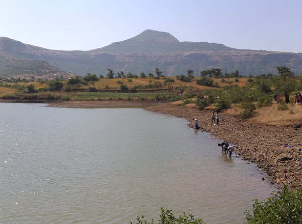
या पर्वतापासुन सात नद्यांचा उगम झाला आहे. गिरणा नदी केम टेकड्यातून उगम पावते आणि पूर्वेला नाशिक व जळगांव जिल्हा ओलांडून जळगाव जिल्ह्यातील उत्तर दिशेला फिरते आणि तापी नदीत सामील होते. नदीकाठावरील धरणे म्हणजे चणकापूर आणि गिरणा धरण. गिरणा हे नाव गिरजा देवीचे नाव आहे (पर्वती) ज्याचे मंदिर पर्वताच्या शिखरावर आहे.
गावकरी नियमितपणे मंदिरात दर्शन घेतात. मार्ग झाडांपासून मुक्त आहे आणि शिखरावर पोहोचणे अगदी सोपे आहे. या पर्वतावर जंगल आहे, ह्या जंगलात खूप वेगवेगळ्या औषधी वनस्पती आहेत. प्रत्येक वर्षी दिवाळीच्या सणाच्या वेळी या ठिकाणी यात्रा भरत असते. ईशान्य दिशेला या प्रदेशातून उगम झालेल्या चार नद्या आहेत. गिरणाचे खोरे डेक्कन पठारावर आहे आणि त्याच्या खोऱ्यात सुपीक माती आहे आणि ती खोलवर शेतात आहे. केम टेकडी नापीक आहे परंतु बर्यापैकी प्रख्यात आहे. एक लांब मार्ग उंच डोंगराला माथ्यावर आणतो.
-------------------------------------------------------------------
A Scenic Mountain: Kem
Kem is the highest mountain in Shinde Digar Village in Surgana Taluka. This mountain falls within the boundaries of Shinde Digar, Rahude, Dangrale, Gogul, Pangarbari Villages.
Kem is an important and attractive mountain standing in the western part of the Satmala ranges. It is located on the Vani–Saputara highway and hence close to Saputara which is a hill station. The Nirhal hill is to its North-East in Lingame Village. Kem is a giant hill on the western edge, South-West of fort Hatgad.
The river Girna originates from the Kem hill and flows East across Nashik and Jalgaon Districts, swinging North in Jalgaon District to join the Tapti River. The dams on the river are Chanakapur and Girna Dam. The name Girna derives from the name of Goddess Giraja (Parvati) whose temple is situated on the top of the mountain.
The village devotees visit the temple regularly. The route is devoid of trees and reaching the top is quite easy. There is a forest on this mountain, there are many different medicinal plants in this forest. Towards the North-East are seen four rivers which have originated from this region. The basin of the Girna lies on the Deccan plateau, and its valley has fertile soils which are intensively farmed. The Kem hill is barren but quite prominent. A long route flanks the hill to the top.


Nice information sir..
ReplyDeleteNice information sir..
ReplyDelete